Discover and enjoy the natural beauty of the island from the pedal of a bike with our suggested itineraries, all created to put you on the ‘right track’ and showcase Cyprus’ stunning landscape.
Cyprus is also part of the cofunded project ‘MedCycleTour’, which is based on the ‘European Mediterranean Route - EuroVelo 8’, one of the 15 long distance cycle routes in the network 'EuroVelo' that connects 11 countries. ‘MedCycleTour’ aims to develop cycle tourism in the Mediterranean region by providing transnational tools to attract visitors. The project is cofunded by the Interreg Mediterranean Programme, the project has a budget of over €2,5 million.
The MedCycleRoute project will contribute to the development of the EuroVelo 8 - Mediterranean Route by exchanging good practices; surveying the existing cycle route; developing regional and transnational action plans; preparing and publishing promotional material related to EuroVelo 8; and implementing pilot projects such as signposting, promotional tools (web sites, apps, etc.) and cycle friendly schemes.
Lead by the Andalusian Government - Agency of Public Works, Andalusian Ministry of Development and Housing (Spain) -, the project has 10 other partners from 7 countries, besides the Deputy Ministry of Tourism. The European Cyclists´ Federation (Belgium), Alpes Maritimes (France), Catalonia Region (Spain), Western Greece (Greece), Friuli Venezia Giulia Region (Italy), Province of Mantova (Italy), Regional Development Center of Koper (Slovenia), Croatian National Tourism Board (Croatia) and the Cluster for Eco-Social Innovation and Development (Croatia).
For more information about EuroVelo please visit: www.eurovelo.com
For more information about EuroVelo 8 please visit: www.eurovelo8.com
For more information about MedCycleTour project please visit: https://medcycletour.interreg-med.eu/ or please contact Thalia Christodoulidou at Diese E-Mail-Adresse ist vor Spambots geschützt! Zur Anzeige muss JavaScript eingeschaltet sein!.
Happy cycling!

Amathus - Germasogia - Arakapas - Eptagonia - Kellaki - Sanida - Vasa - Asgata - Monagroulli - Moni - Pyrgos - Amathus
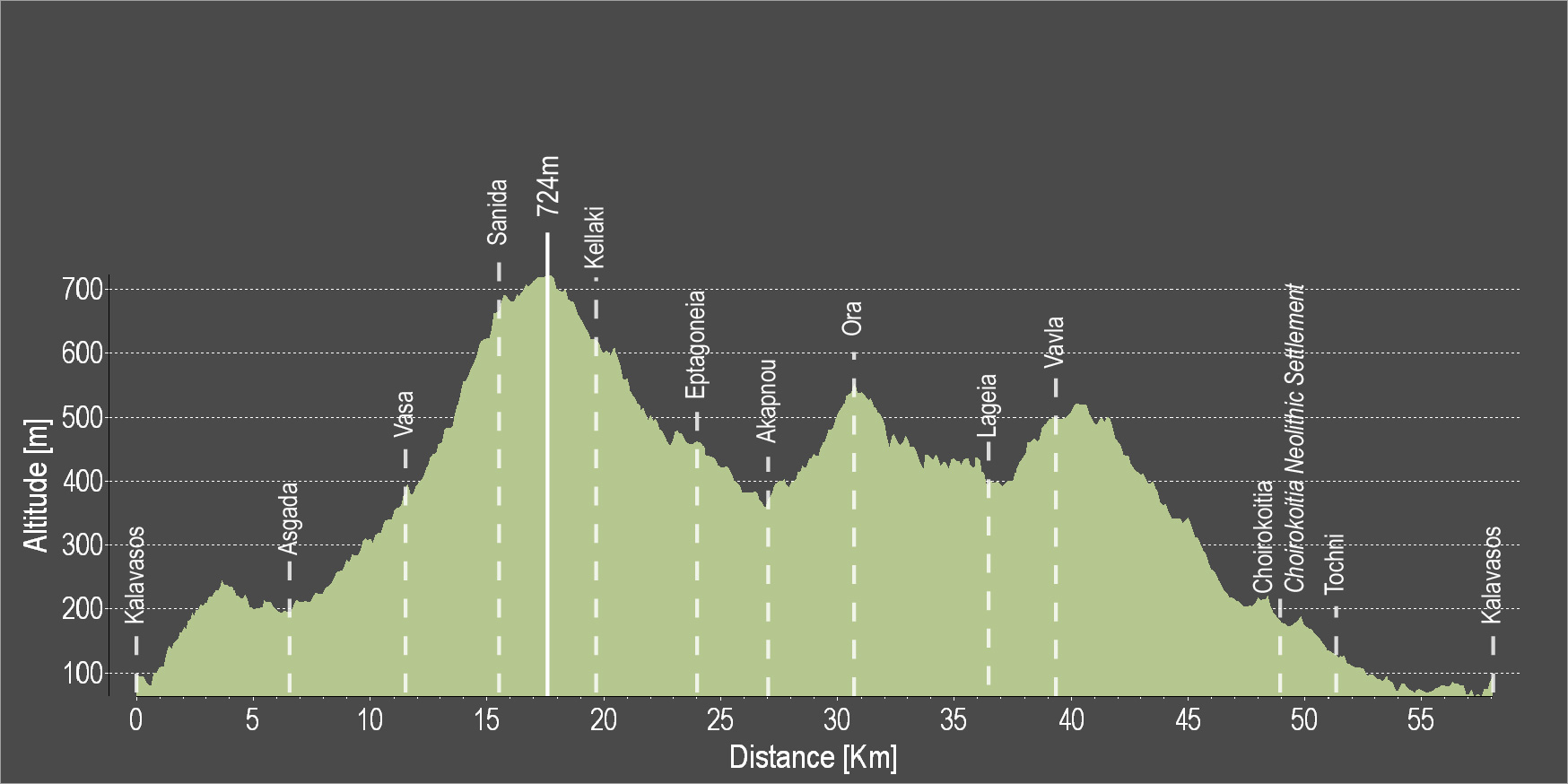
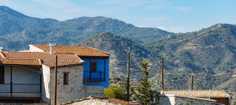
Eine fordernde Runde, die von Kalavasos entlang der Gebirgsstraße nach Kellaki führt und dabei herrliche Blicke auf den Mount Olympus im Nordwesten und das Vasilikos-Tal zur rechten eröffnet. Das Land zwischen Eptagonia und Vavla ist von Lavaböden und satten Wäldern geprägt. Dann ändert sich die Landschaft plötzlich Wieder zu Kalkstein. Nun geht es entlang des beeindruckenden Maroni-Tals einem schon in der späten Bronzezeit (1.650-1.050 v. Chr.) wichtigen Siedlungsraum - über Choirokoitia und Tochni zurück nach Kalavasos.
Bitte klicken sie hier zum download die beschreibung der route.
Bitte klicken sie hier zum download die route im gpx-format.
| Distance: | 57.6km |
| Elevation Gain: | 1169m |
| Highest point: | 724m |
| Lowest point: | 65m |
| Loop: | YES |
| Terrain: | Mountain |
| Road surface: | Paved |
| Section Distance (km) | Total Distance (km) | |
| Kalavasos | 0,0 | 0,0 |
| Asgada | 6.6 | 6.6 |
| Vasa | 5.1 | 11.7 |
| Sanida | 3.6 | 15.3 |
| Kellaki | 4.1 | 19.4 |
| Eptagonia | 4.5 | 23.9 |
| Akapnou | 3.0 | 26.9 |
| Ora | 3.5 | 30.4 |
| Lageia | 6.3 | 36.7 |
| Vavla | 2.4 | 39.1 |
| Choirokoitia | 9.7 | 48.8 |
| Choirokoitia Neolithic Settlement | 0.0 | 48.8 |
| Tochni | 2.8 | 51.6 |
| Kalavasos | 6.0 | 57.6 |