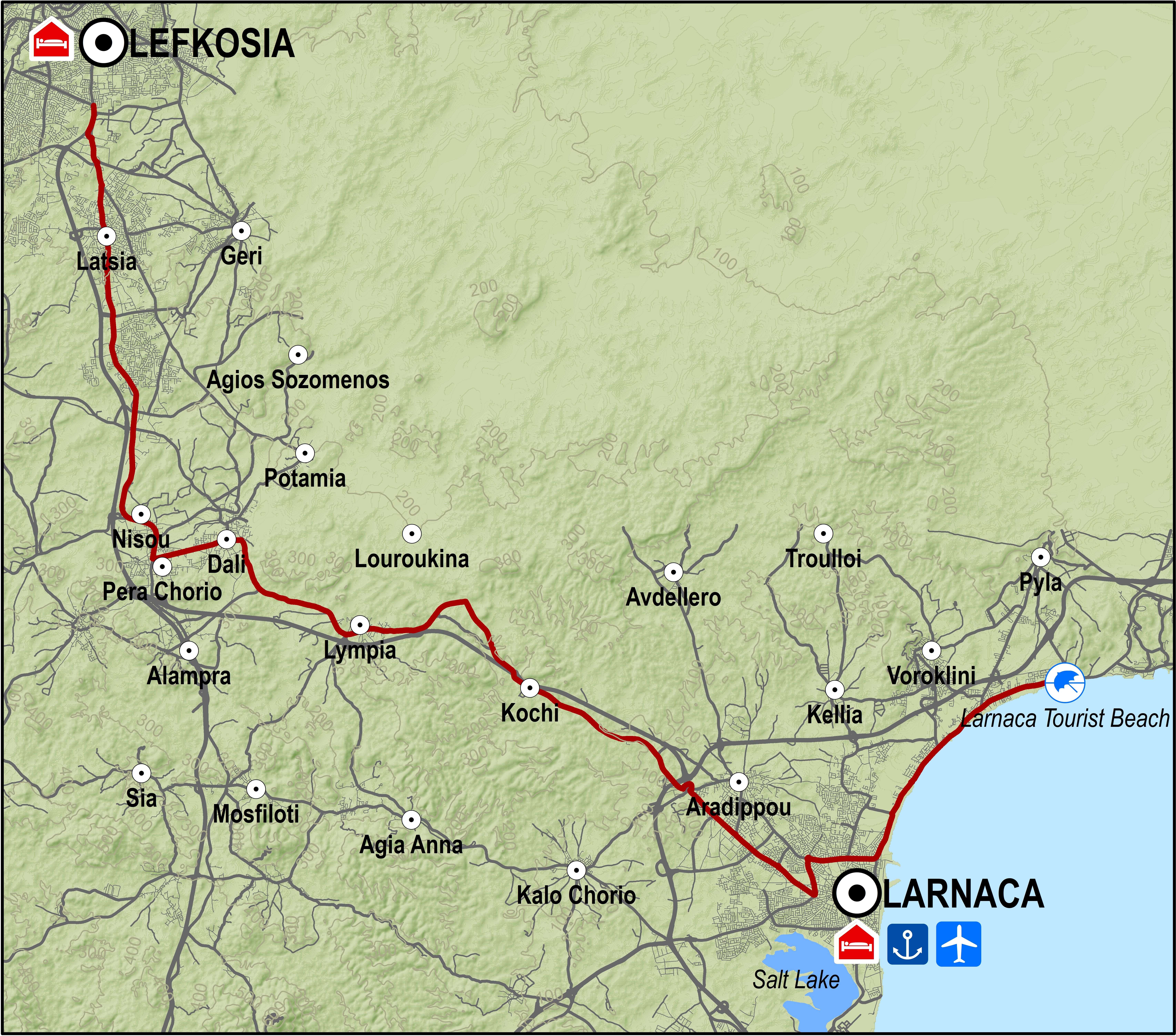
At Nisou the route turns to the left heading east towards the small town of Dali. It goes through both Dali and the next village Lympia and then reaches the old Lefkosia-Larnaka road.
From there it turns right heading northeast and travels parallel to the Lefkosia-Larnaka motorway until it reaches Rizoelia on the outskirts of Aradippou. From that point on, the route goes along the motorway next to the Larnaka industrial area and ends up at the Agios Georgios traffic lights. The Fire Department traffic lights are 1km down the road.
Turning left at the Fire Department traffic lights leads to Stratigou Timagia avenue and the roundabout just outside Larnaka port. The route then enters the tourist area of Livadia, Voroklini and Pyla with its camping site in a small eucalyptus grove. It ends at the Larnaka Tourist Beach a little further down the road, having covered a distance of 53.4km.
Road condition: The entire route is on paved roads.
Route Description: This route is convenient for getting from Lefkosia to Larnaka and the coastal area outside the town. The course travels along the old Lefkosia-Lemesos road until Nisou and then on the old Larnaka-Nisou road.
To download the route in gpx format click here
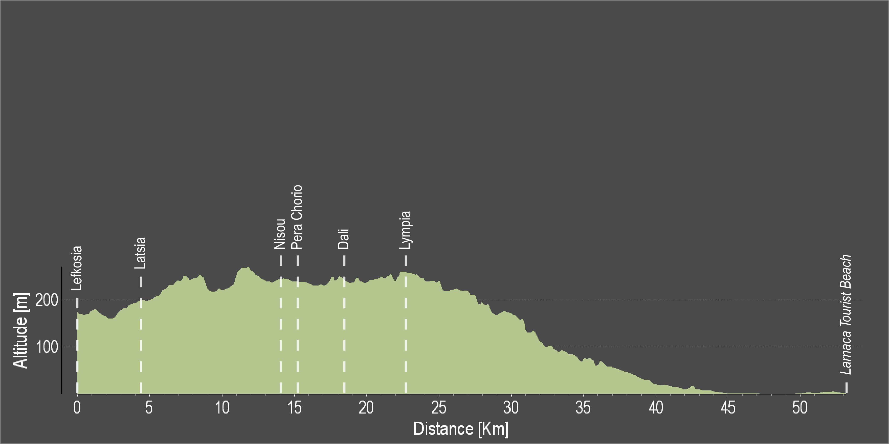
| Distance: | 53.4km |
| Elevation Gain: | 249m |
| Highest point: | 268m |
| Lowest point: | 1m |
| Loop: | NO |
| Terrain: | Flat |
| Road surface: | Paved |
| Section Distance (km) | Total Distance (km) | |
| Lefkosia | 0,0 | 0,0 |
| Latsia | 4,2 | 4,2 |
| Nisou | 9,8 | 14,0 |
| Pera Chorio | 1,1 | 15,1 |
| Dali | 2,4 | 17,5 |
| Lympia | 5,2 | 22,7 |
| Larnaka Fire Department traffic lights | 19,0 | 41,7 |
| Larnaka Port roundabout | 3,3 | 45,0 |
| Larnaka Tourist Beach | 8,4 | 53,4 |