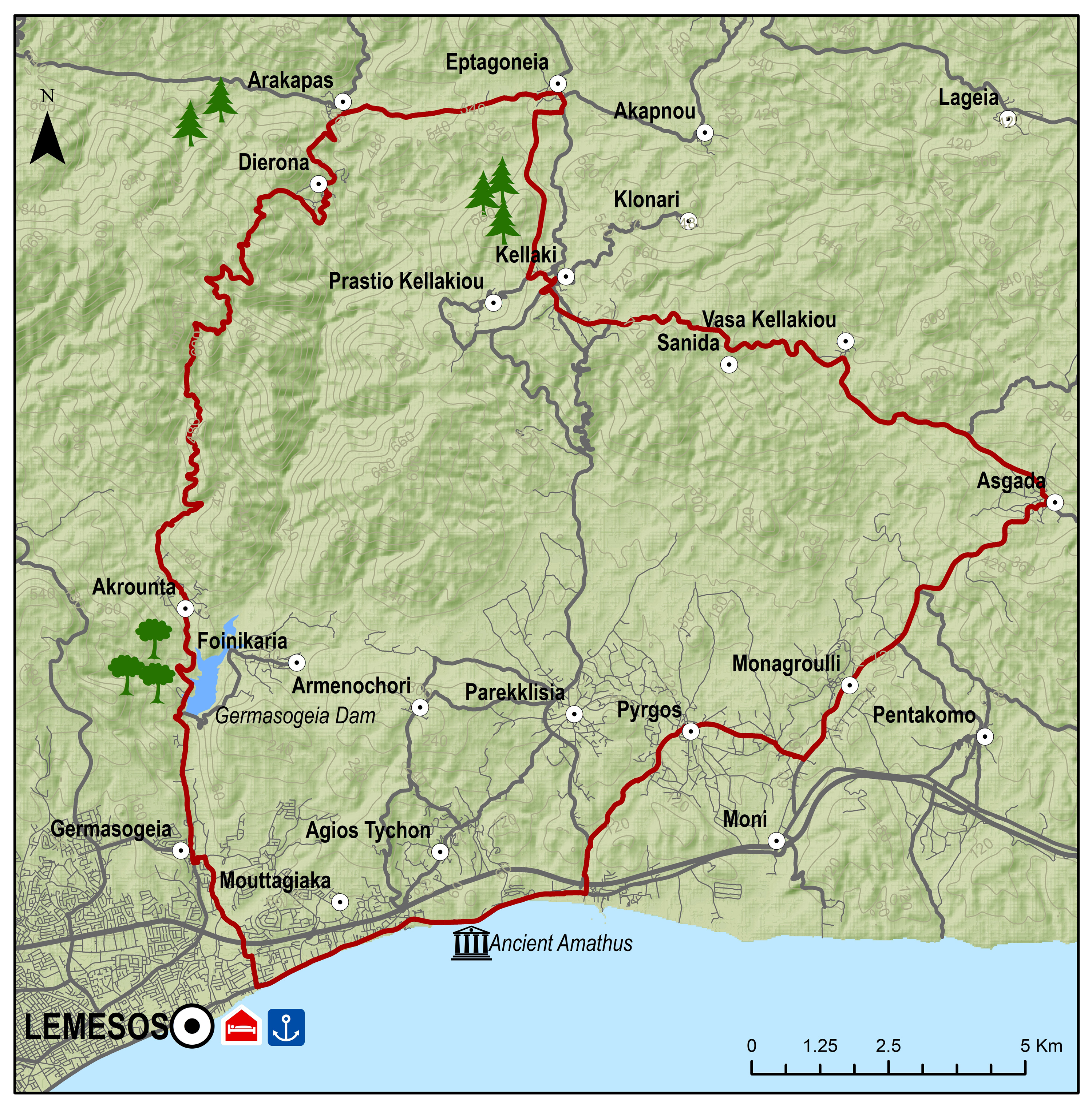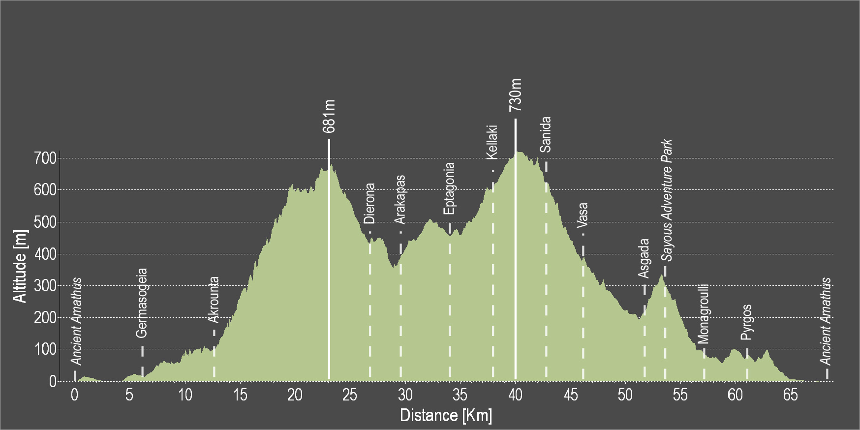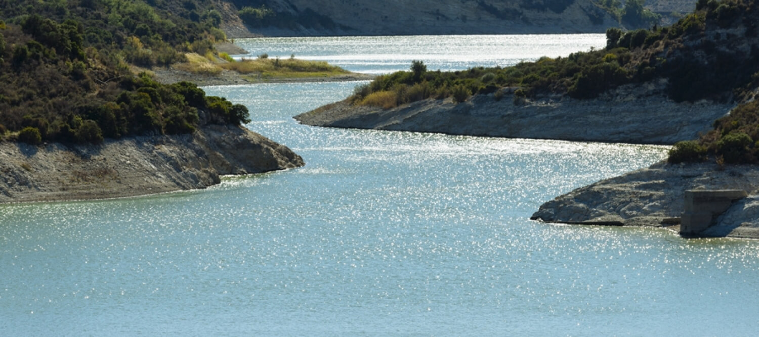
The route is directed towards the coast and turns towards Germasogeia. It passes by the Germasogeia Reservoir and then heads towards the Akrounta Village. After a challenging 9 km uphill ride, the route leads to the small village of Dierona and then to Arakapas and Eptagoneia. Then, while heading towards Kellaki and Sanida there is a big downhill ride with a view of the beach and the beautiful blue water. Vasa, Asgata and Monagroulli are the next three villages the route passes by and then turns towards Pyrgos and ends at the starting point in Amathous.
To download the route in gpx format click here
| Distance: | 67.3km |
| Elevation Gain: | 1494m |
| Highest point: | 731m |
| Lowest point: | 9m |
| Loop: | YES |
| Terrain: | Mountain |
| Road surface: | Paved |
| Section Distance (km) | Total Distance (km) | |
| Ancient Amathus | 0,0 | 0,0 |
| Germasogia | 6.5 | 6.5 |
| Akrounta | 5.8 | 12.3 |
| Dierona | 14.6 | 26.9 |
| Arakapas | 2.3 | 29.2 |
| Eptagonia | 4.2 | 33.4 |
| Kellaki | 4.2 | 37.6 |
| Sanida | 5.2 | 42.8 |
| Vasa | 3.1 | 45.9 |
| Asgada | 5.5 | 51.4 |
| Sayous Adventure Park | 1.5 | 52.9 |
| Monagroulli | 4.2 | 57.1 |
| Pyrgos | 4.0 | 61.1 |
| Ancient Amathus | 6.2 | 67.3 |