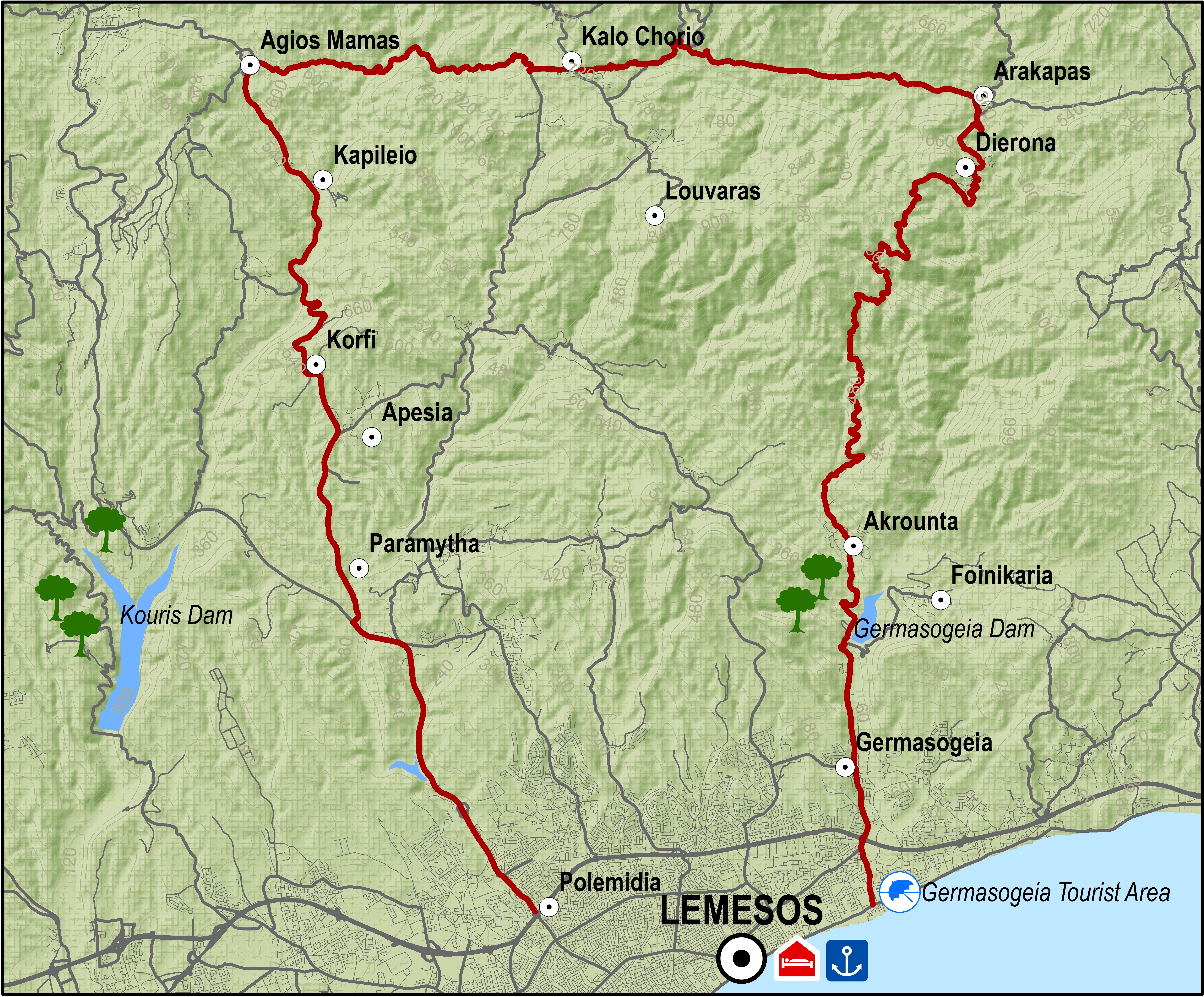
At Arakapas, the route turns west and continues climbing steadily to the village of Kalo Chorio where it meets the Lemesos - Pitsylia road. Heading in the direction of Lemesos, a short distance down the road and to the right, is the dirt road that leads to Agios Mamas. From Agios Mamas the route begins to descend along a paved road passing through the villages of Kapileio and Korfi to reach the roundabout of Polemidia on the outskirts of Lemesos.
Difficulty rate: Average.It requires a road bike with at least 20 speeds.
Road condition: Entirely paved roads.
To download the route in gpx format click here
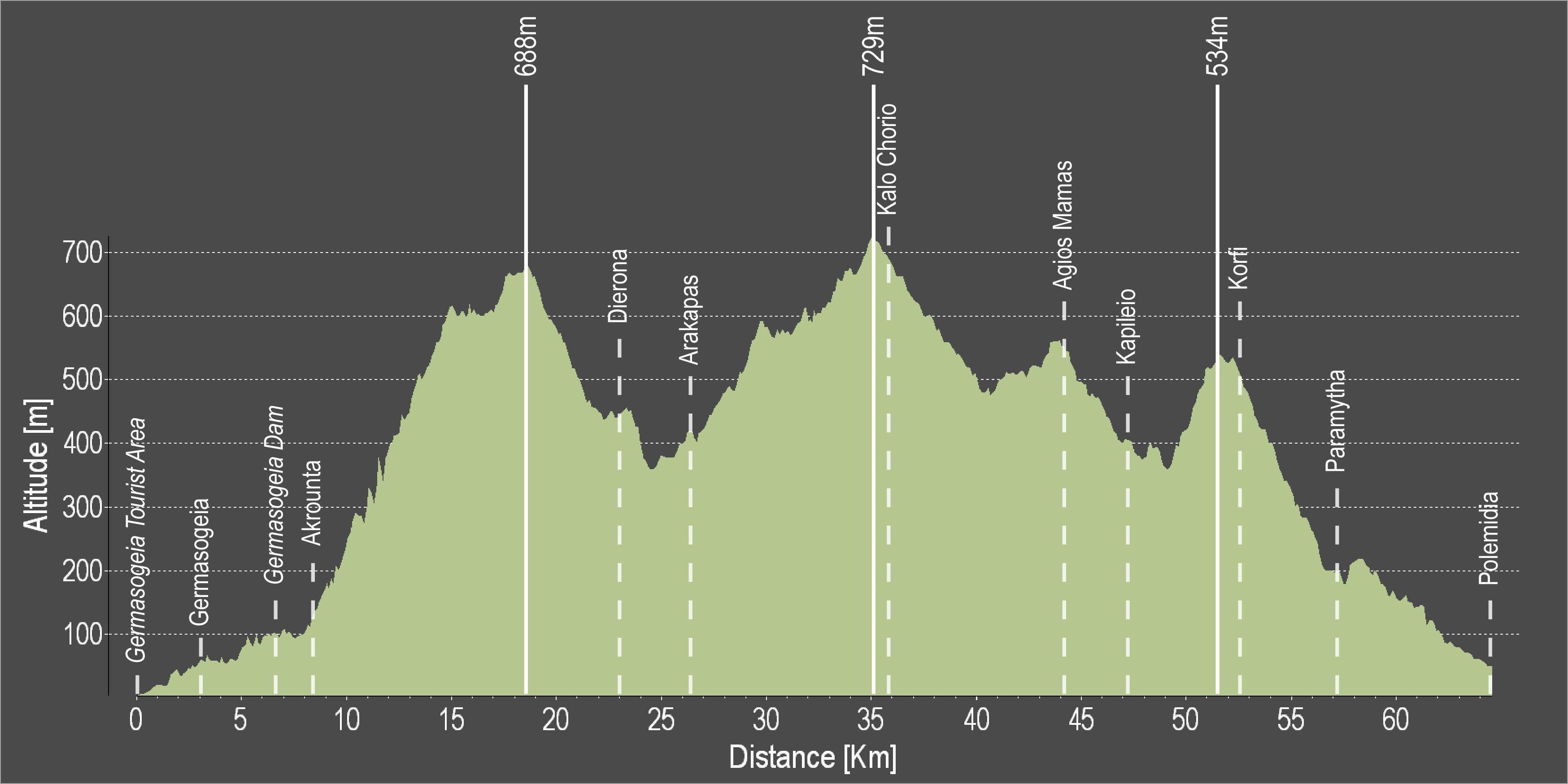
| Distance: | 65.9km |
| Elevation Gain: | 2007m |
| Highest point: | 729m |
| Lowest point: | 7m |
| Loop: | NO |
| Terrain: | Mountain |
| Road surface: | Paved |
| Section Distance (km) | Total Distance (km) | |
| Germasogeia Tourist Area | 0,0 | 0,0 |
| Germasogeia | 3,0 | 3,0 |
| Germasogeia Dam | 3,6 | 6,6 |
| Akrounta | 1,7 | 8,3 |
| Dierona | 15,6 | 23,9 |
| Arakapas | 2,3 | 26,2 |
| Kalo Chorio | 9,5 | 35,7 |
| Agios Mamas | 8,4 | 44,1 |
| Kapileio | 3,1 | 47,2 |
| Korfi | 5,4 | 52,6 |
| Paramytha | 4,6 | 57,2 |
| Polemidia | 8,7 | 65,9 |