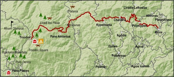
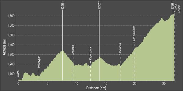
At Chandria it turns right and heads west, through Kyperounta to reach the crossroads at Karvounas. From Karvounas it heads south climbing steeply towards Pano Amiantos and then heads west climbing even more steeply to Troodos square. Before reaching the square it goes past the picnic sites of Almyrolivado and Livadi tou Pasa as well as a camping and a picnic site just before the square.
Difficulty rate: Quite a difficult course. It requires a road bike with low/ easy gear ratios.
Road condition: Paved roads throughout.
Route Description: This route connects the areas of Pitsylia and Troodos. It is an interesting route for visiting the surrounding villages.
To download the route in gpx format click here
| Distance: | 26.3km |
| Elevation Gain: | 1434m |
| Highest point: | 1726m |
| Lowest point: | 1046m |
| Loop: | NO |
| Terrain: | Mountain |
| Road surface: | Paved |
| Section Distance (km) | Total Distance (km) | |
| Alona | 0,0 | 0,0 |
| Polystypos | 3,5 | 3,5 |
| Chandria | 5,8 | 9,3 |
| Kyperounta | 3,0 | 12,3 |
| Karvounas | 5,0 | 17,3 |
| Pano Amiantos | 2,6 | 19,9 |
| Troodos Square | 6,4 | 26,3 |


