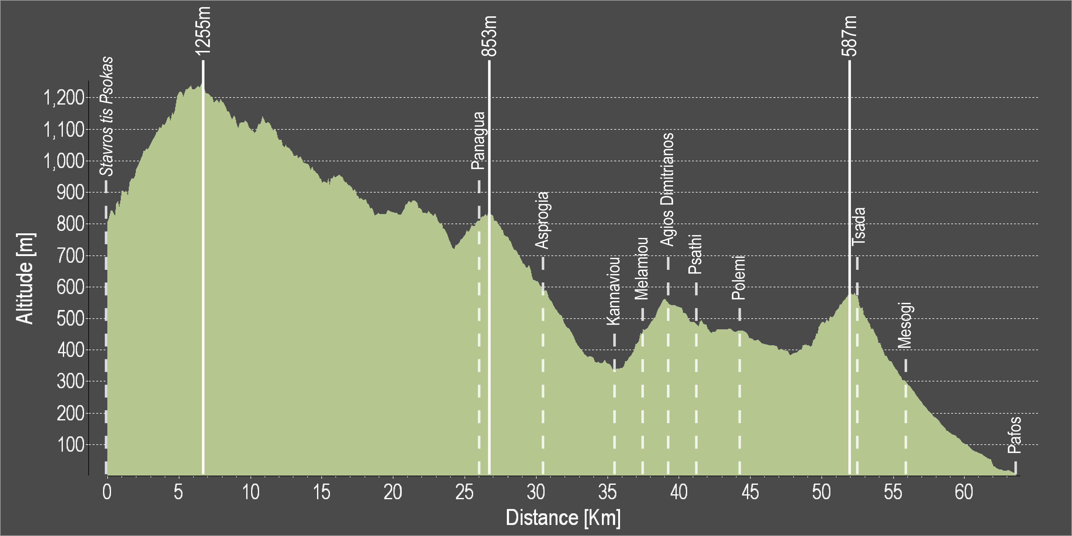
The route continues towards Pafos, going through the villages of Asprogia, Kannaviou, Agios Dimitrianos, Psathi, Polemi, Kallepeia, Tsada and Mesogi.
Difficulty rate: Despite being mostly downhill, there are quite a few steep uphills
Road condition: The route is entirely on paved roads.
Route Description: This excursion links the mountainous areas of Troodos and Kykkos with Pafos.
To download the route in gpx format click here
| Distance: | 64.2km |
| Elevation Gain: | 2251m |
| Highest point: | 1255m |
| Lowest point: | 1m |
| Loop: | NO |
| Terrain: | Mountain |
| Road surface: | Paved |
| Section Distance (km) | Total Distance (km) | |
| Stavros tis Psokas | 0,0 | 0,0 |
| Panagia | 26,6 | 26,6 |
| Asprogia | 3,9 | 30,5 |
| Kannaviou | 5,1 | 35,6 |
| Melamiou | 2,0 | 37,6 |
| Agios Dimitrianos | 1,6 | 39,2 |
| Psathi | 1,9 | 41,1 |
| Polemi | 3,1 | 44,2 |
| Tsada | 8,3 | 52,5 |
| Mesogi | 3,5 | 56,0 |
| Pafos | 8,2 | 64,2 |