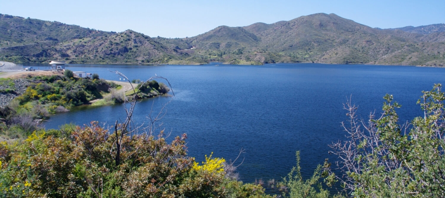
The route starts from the village of Kalavasos and goes uphill passing by the Kalavasos Reservoir. The route is circular, it is mostly on a dirt road and some parts of it require good technical cycling skills.
To download the route in gpx format click here
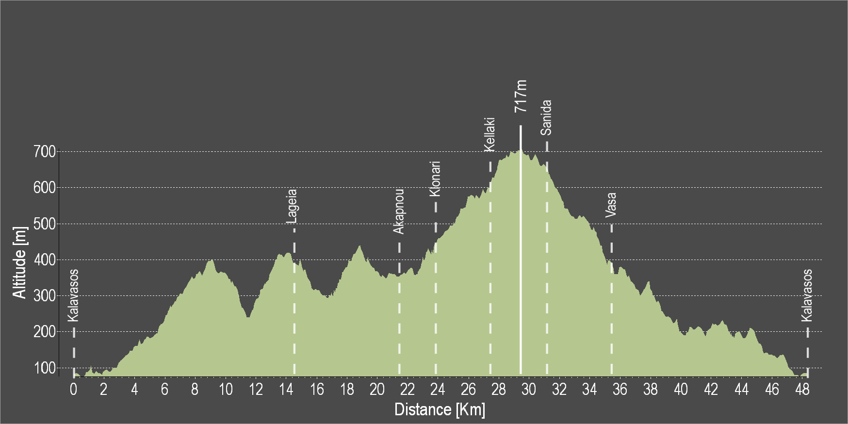
| Distance: | 46.8km |
| Elevation Gain: | 1167m |
| Highest point: | 717m |
| Lowest point: | 72m |
| Loop: | YES |
| Terrain: | Mountain |
| Section Distance (km) | Total Distance (km) | |
| Kalavasos | 0.0 | 0.0 |
| Lageia | 14.7 | 14.7 |
| Akapnou | 6.8 | 21.5 |
| Klonari | 2.4 | 23.9 |
| Kelaki | 3.1 | 27.0 |
| Sanida | 3.4 | 30.4 |
| Vasa | 5.0 | 35.4 |
| Kalavasos | 11.4 | 46.8 |