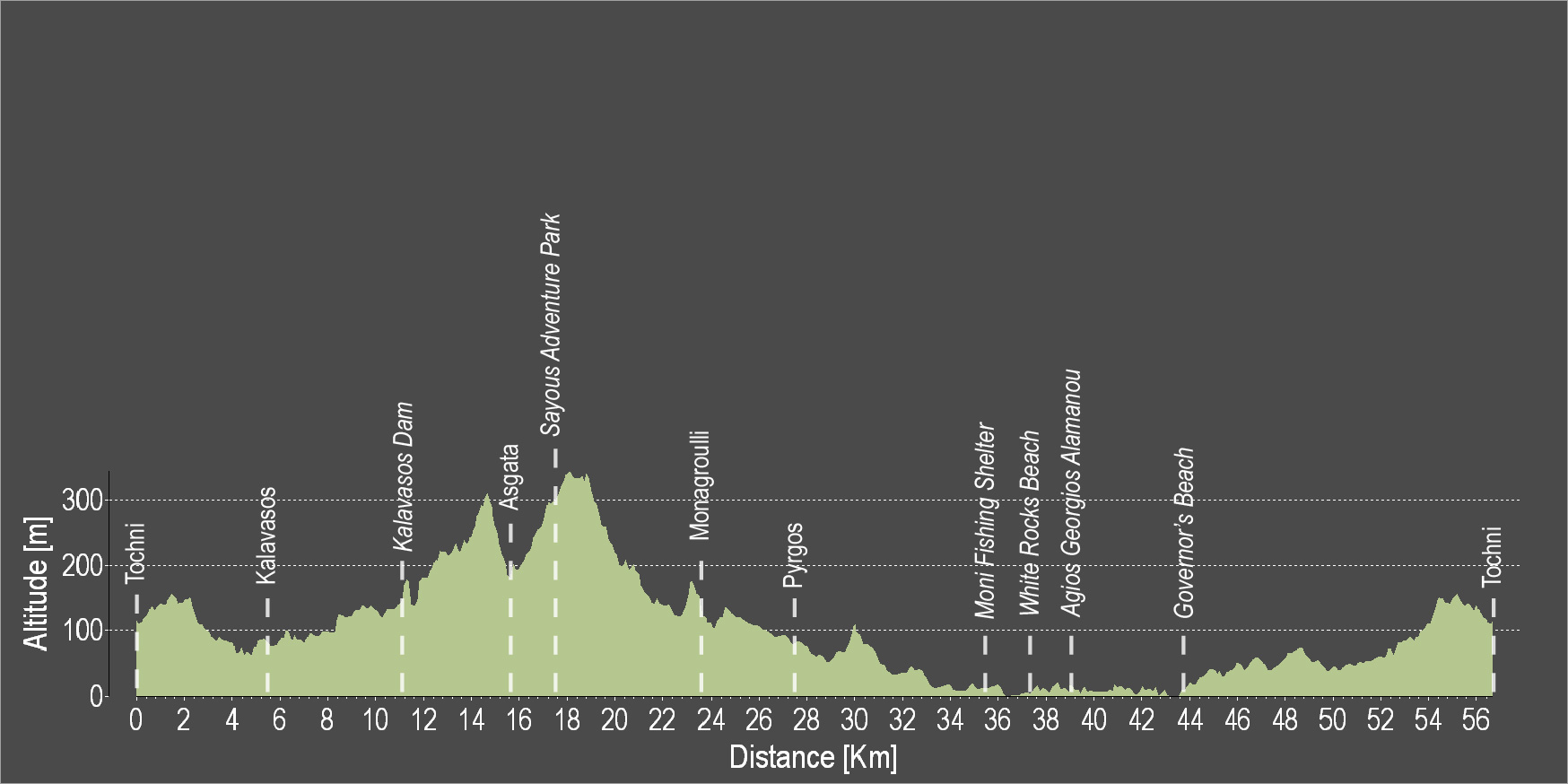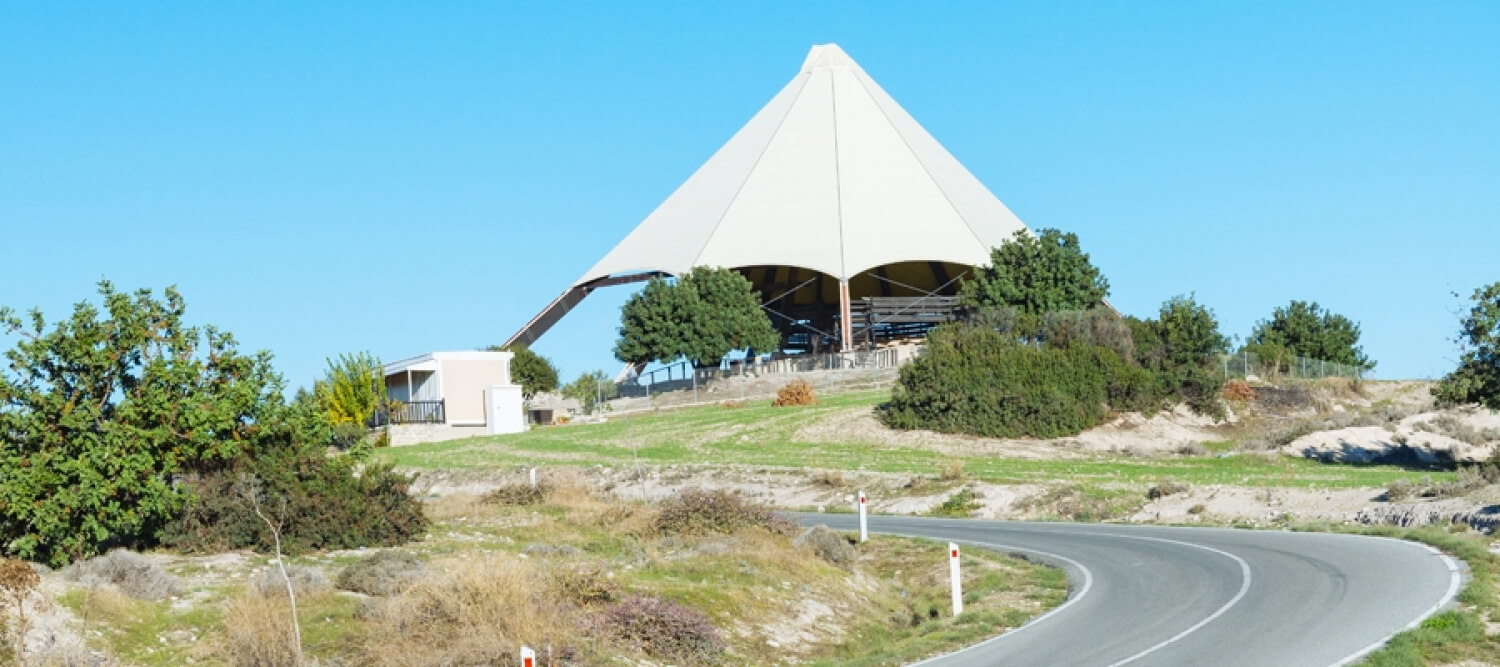
The route starts from the beautiful Tochni and heads towards Kalavasos. At a short distance from Kalavasos lies the Tenta Neolithic Settlement dating back to 7000 BC. It is one of the most important Neolithic Settlements on the island and is sheltered by a distinctive cone-shaped roof, which is a contemporary architectural intervention in the landscape. Subsequently, the route ascends towards the Kalavasos Reservoir. Next, discover the village of Asgata, then continue uphill to the adventure theme park and downhill again to Monagroulli and Pyrgos. The route continues along the coast, passing by the Moni Fishing Shelter, the impressive White Rocks coastal area, the beach of Agios Georgios Alamanos and the Governor's Beach, to then head uphill and end in Tochni.
To download the route in gpx format click here
| Distance: | 56.9km |
| Elevation Gain: | 864m |
| Highest point: | 355m |
| Lowest point: | 0m |
| Loop: | YES |
| Terrain: | Mixed |
| Section Distance (km) | Total Distance (km) | |
| Tochni | 0.0 | 0.0 |
| Kalavasos | 5.5 | 5.5 |
| Kalavasos Dam | 6.3 | 11.8 |
| Asgada | 4.5 | 16.3 |
| Sayous Adventure Park | 1.9 | 18.2 |
| Monagrouli | 5.9 | 24.1 |
| Pyrgos | 4.1 | 28.2 |
| Moni Fishing Shelter | 7.8 | 36.0 |
| White Rocks Beach | 2.0 | 38.0 |
| Agios Georgios Alamanos Beach | 1.1 | 39.1 |
| Governor's Beach | 4.3 | 43.4 |
| Tochni | 13.5 | 56.9 |