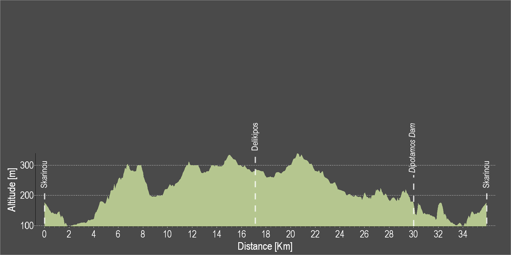
The route starts from Skarinou village and heads north, mostly uphill, towards the Delikipos village, through, for the most part, dirt roads. After reaching the main road of Delikipos-Kronos, the route turns left to re-enter the dirt road after a short distance and head to the Dipotamos Reservoir. Descending to the west side of the reservoir, the route ends at the starting point in Skarinou.
To download the route in gpx format click here
| Distance: | 36.3km |
| Elevation Gain: | 722m |
| Highest point: | 335m |
| Lowest point: | 102m |
| Loop: | YES |
| Terrain: | Mixed |
| Section Distance (km) | Total Distance (km) | |
| Skarinou | 0.0 | 0.0 |
| Delikipos | 17.4 | 17.4 |
| Dimotapos Dam | 12.6 | 30.0 |
| Skarinou | 6.3 | 36.3 |