Menu

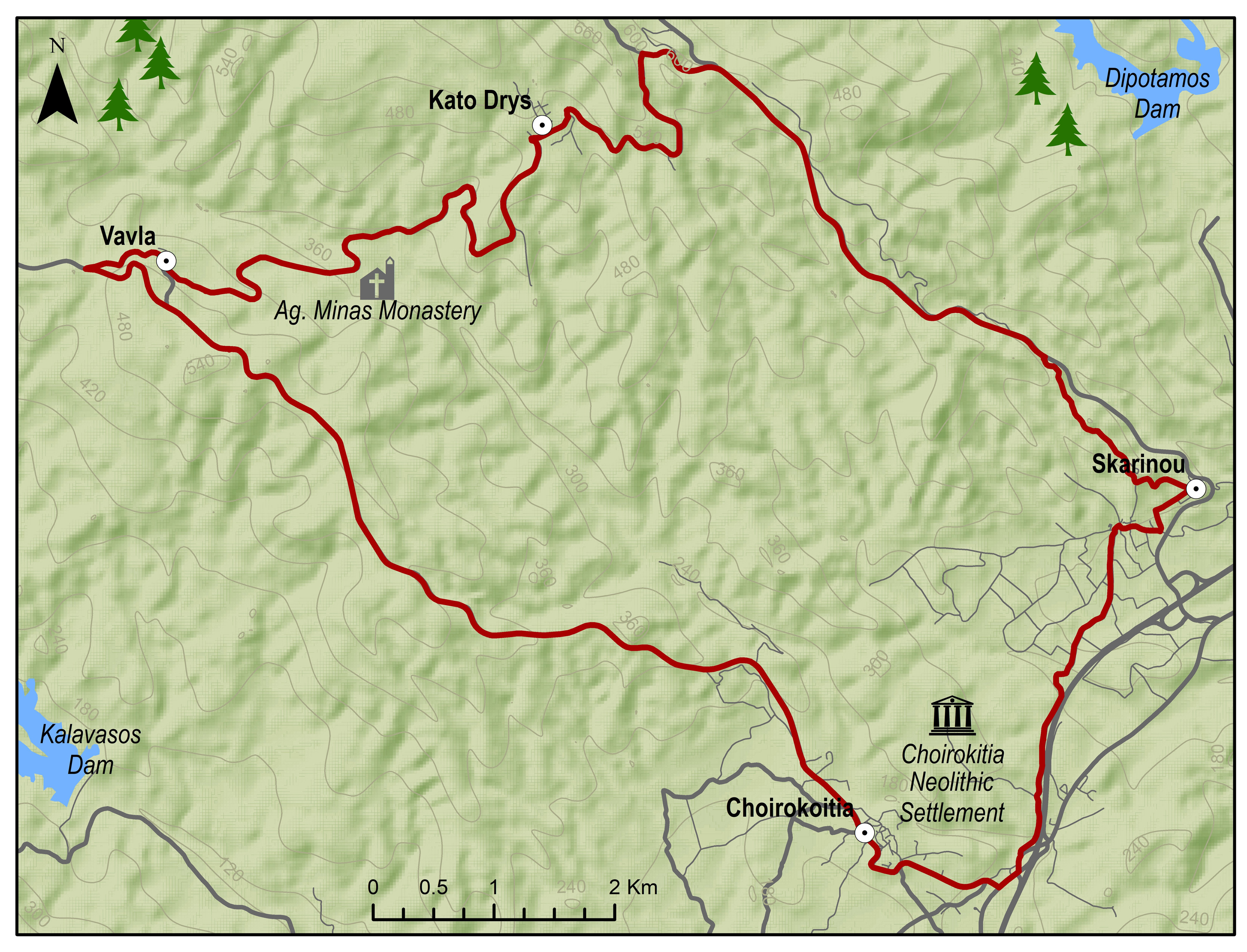
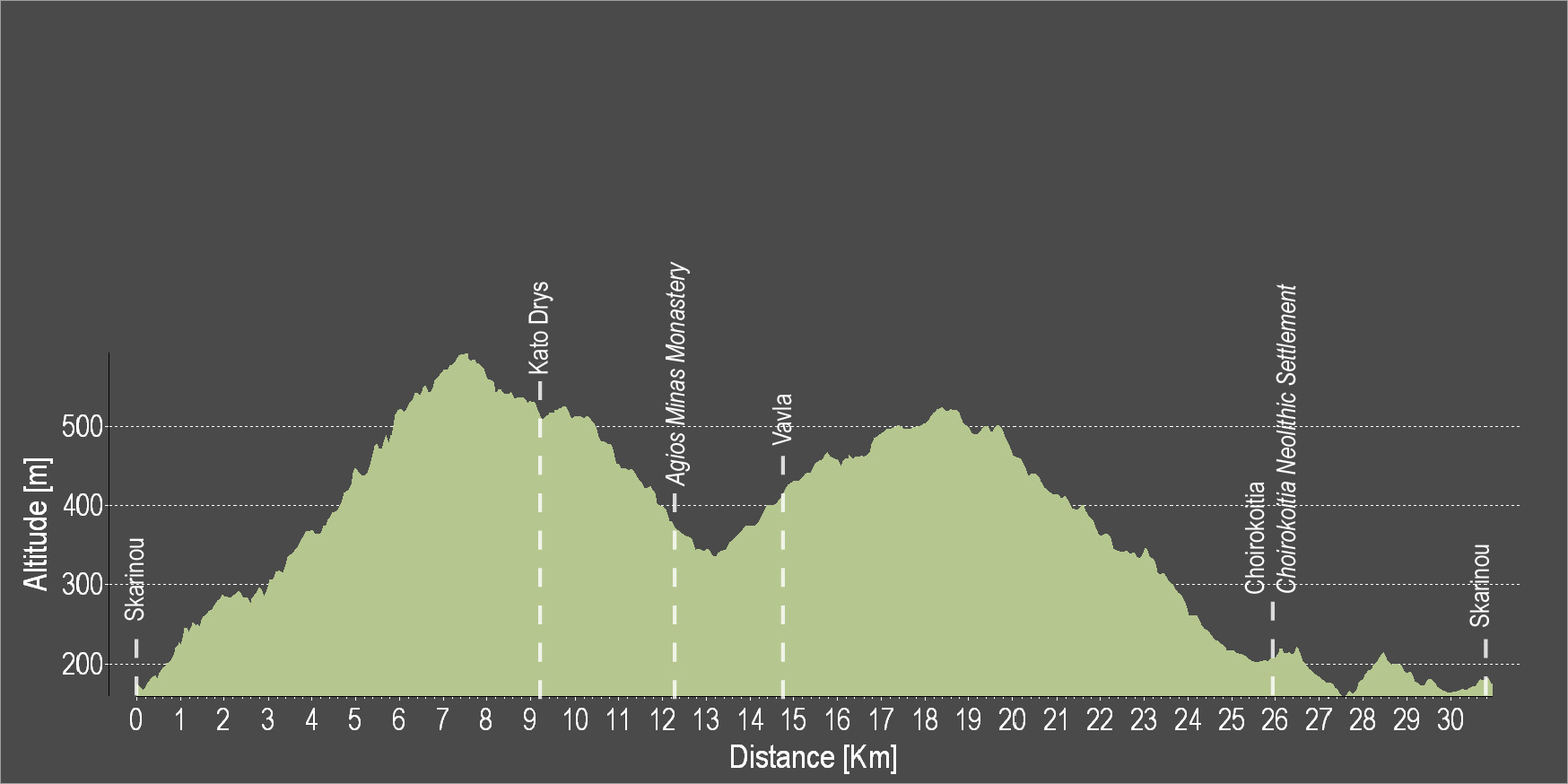
The route starts from the village of Skarinou, and continues upward to Kato Drys. Pass through a pine woodland to reach the Monastery of Agios Minas and climb towards the Vavla village. Then, a big downhill ride with beautiful views will lead to Choirokoitia and then to the starting point in Skarinou.
To download the route in gpx format click here
| Distance: | 30.1km |
| Elevation Gain: | 743m |
| Highest point: | 593m |
| Lowest point: | 156m |
| Loop: | YES |
| Terrain: | Mixed |
| Road surface: | Paved |
| Section Distance (km) | Total Distance (km) | |
| Skarinou | 0.0 | 0.0 |
| Kato Drys | 9.1 | 9.1 |
| Agios Minas Monastery | 3.1 | 12.2 |
| Vavla | 2.5 | 14.7 |
| Choirokoitia | 11.2 | 25.9 |
| Choirokoitia Neolithic Settlement | 0.0 | 25.9 |
| Skarinou | 4.2 | 30.1 |
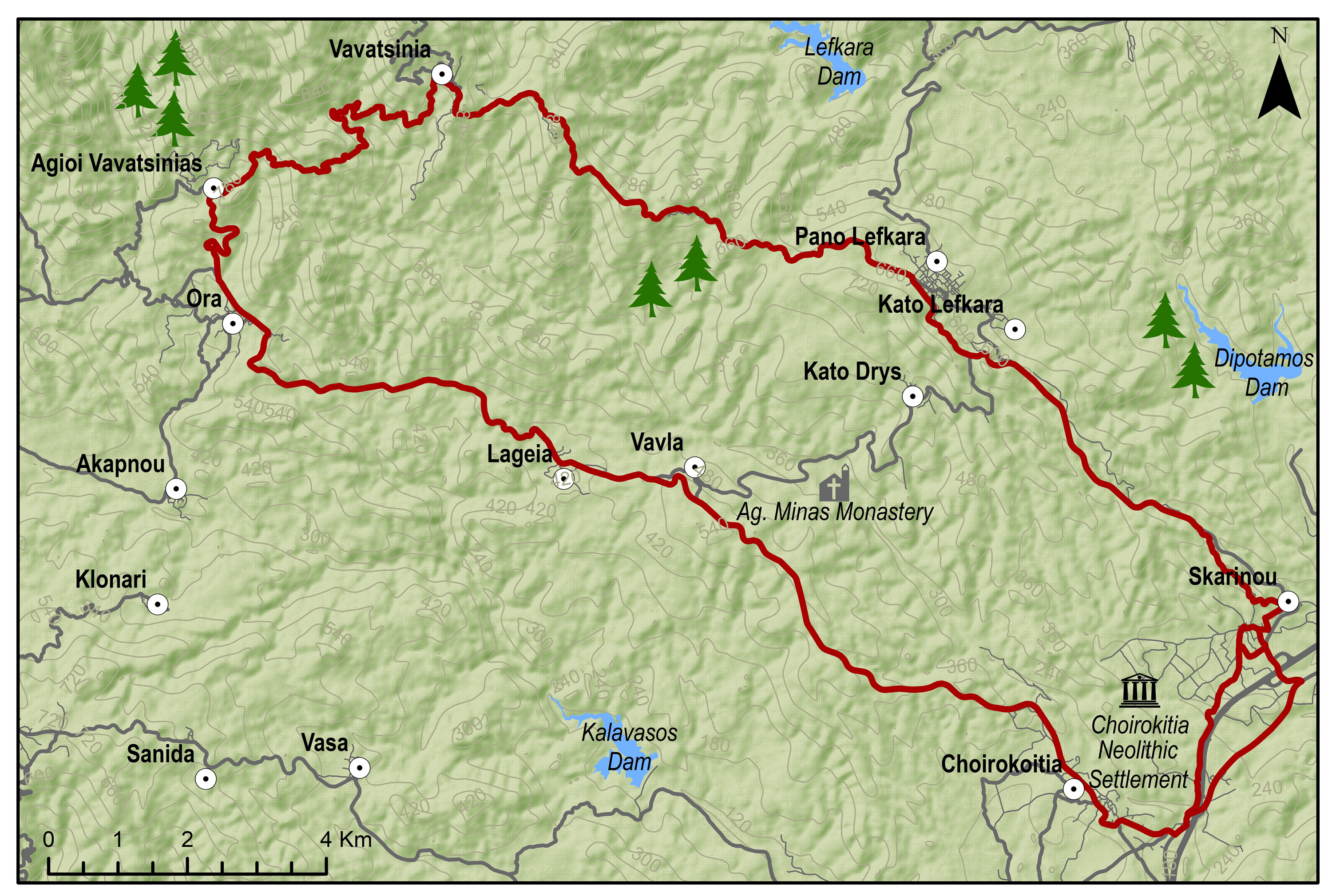
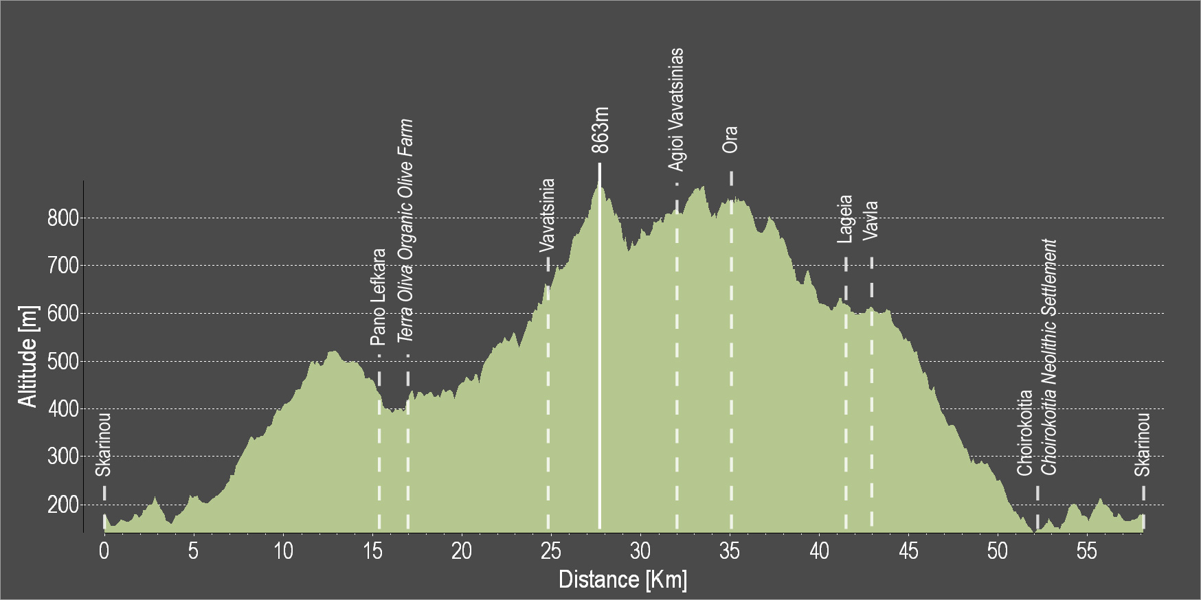
The route starts from the village of Skarinou and ascends to the village of Lefkara, known for its traditional embroidered lace and silver wire crafts. Just outside the village, you can visit the organic olive grove before continuing to the picturesque Vavatsinia and to Agioi Vavatsinias. Continue onward for Ora, Lageia, Vavla and ride downhill to Choirokoitia where the Neolithic Settlement of Choirokoitia is located, which has been listed as a UNESCO World Heritage Site since 1998. The route ends at the starting point in Skarinou.
To download the route in gpx format click here
| Distance: | 56.8km |
| Elevation Gain: | 1299m |
| Highest point: | 863m |
| Lowest point: | 142m |
| Loop: | YES |
| Terrain: | Mountain |
| Road surface: | Paved |
| Section Distance (km) | Total Distance (km) | |
| Skarinou | 0.0 | 0.0 |
| Pano Lefkara | 15.2 | 15.2 |
| Terra Oliva Organic Olive Farm | 1.3 | 16.5 |
| Vavatsinia | 8.5 | 25.0 |
| Agioi Vavatsinias | 7.0 | 32.0 |
| Ora | 2.7 | 34.7 |
| Lageia | 6.7 | 41.4 |
| Vavla | 1.9 | 43.3 |
| Choirokoitia | 8.9 | 52.2 |
| Choirokoitia Neolithic Settlement | 0.0 | 52.2 |
| Skarinou | 4.6 | 56.8 |
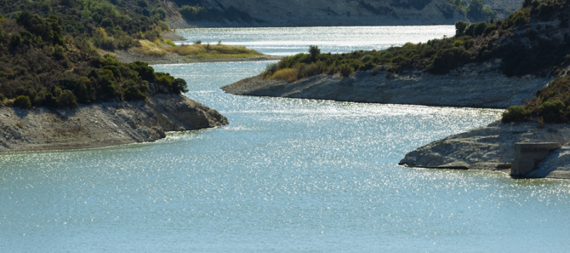
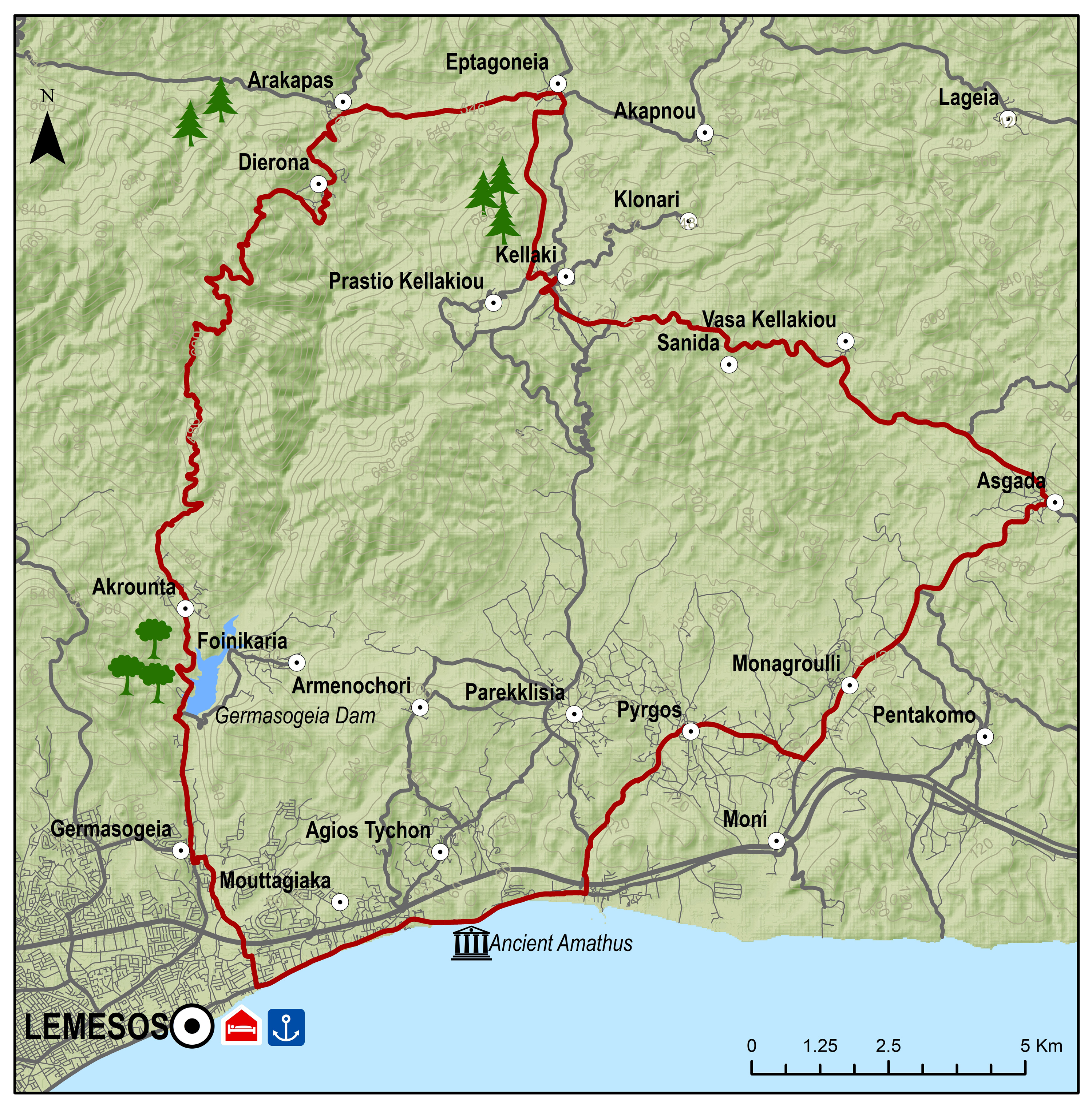
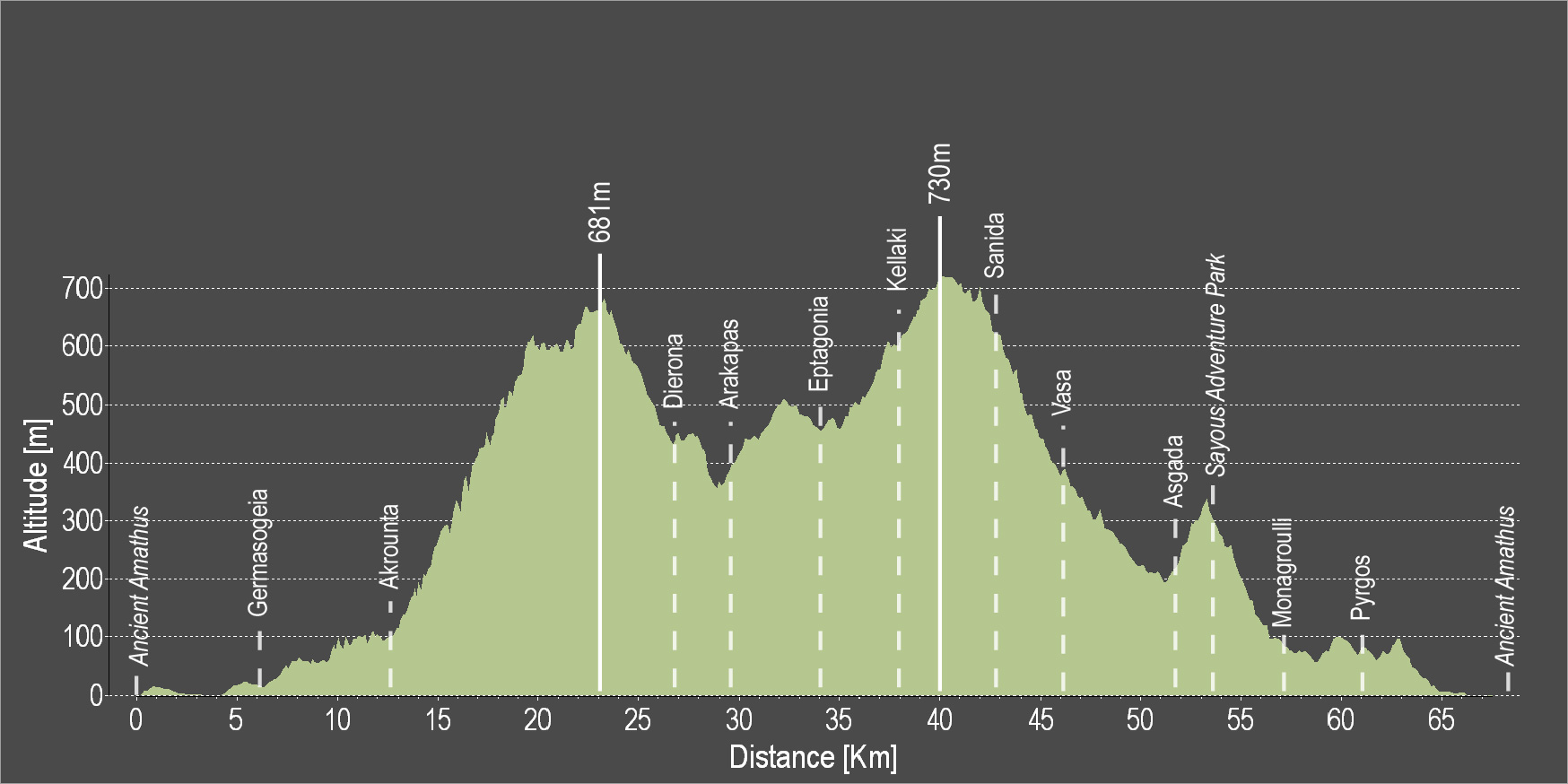
The route is directed towards the coast and turns towards Germasogeia. It passes by the Germasogeia Reservoir and then heads towards the Akrounta Village. After a challenging 9 km uphill ride, the route leads to the small village of Dierona and then to Arakapas and Eptagoneia. Then, while heading towards Kellaki and Sanida there is a big downhill ride with a view of the beach and the beautiful blue water. Vasa, Asgata and Monagroulli are the next three villages the route passes by and then turns towards Pyrgos and ends at the starting point in Amathous.
To download the route in gpx format click here
| Distance: | 67.3km |
| Elevation Gain: | 1494m |
| Highest point: | 731m |
| Lowest point: | 9m |
| Loop: | YES |
| Terrain: | Mountain |
| Road surface: | Paved |
| Section Distance (km) | Total Distance (km) | |
| Ancient Amathus | 0,0 | 0,0 |
| Germasogia | 6.5 | 6.5 |
| Akrounta | 5.8 | 12.3 |
| Dierona | 14.6 | 26.9 |
| Arakapas | 2.3 | 29.2 |
| Eptagonia | 4.2 | 33.4 |
| Kellaki | 4.2 | 37.6 |
| Sanida | 5.2 | 42.8 |
| Vasa | 3.1 | 45.9 |
| Asgada | 5.5 | 51.4 |
| Sayous Adventure Park | 1.5 | 52.9 |
| Monagroulli | 4.2 | 57.1 |
| Pyrgos | 4.0 | 61.1 |
| Ancient Amathus | 6.2 | 67.3 |