Menu

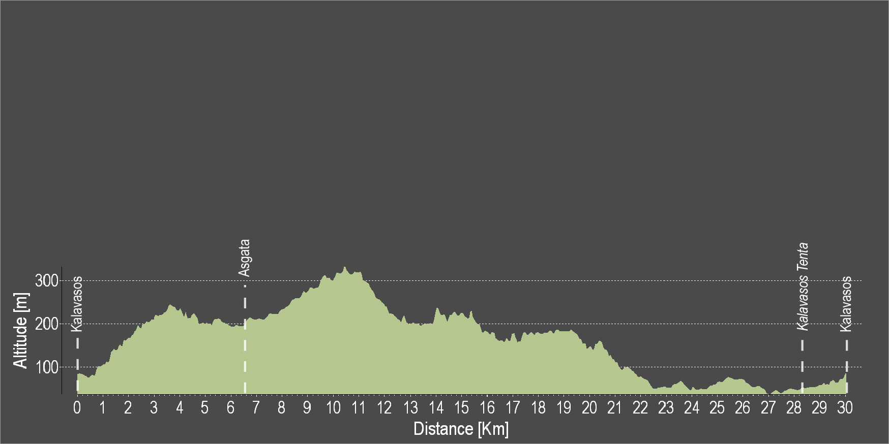
The route starts from the village of Kalavasos and heads north to the village of Asgata. It continues towards the north and enters a downhill dirt road. The dirt road leads almost down to the beach. Continue straight ahead from the main road. Turn left towards Tenta and the Archaeological Monument, the Settlement of the Neolithic Age. Then continue straight again and end the route at Kalavasos.
To download the route in gpx format click here
| Distance: | 30.2km |
| Elevation Gain: | 453m |
| Highest point: | 325m |
| Lowest point: | 39m |
| Loop: | YES |
| Terrain: | Mixed |
| Section Distance (km) | Total Distance (km) | |
| Kalavasos | 0.0 | 0.0 |
| Asgada | 6.3 | 6.3 |
| Kalavasos Tenta | 21.3 | 27.6 |
| Kalavasos | 2.6 | 30.2 |

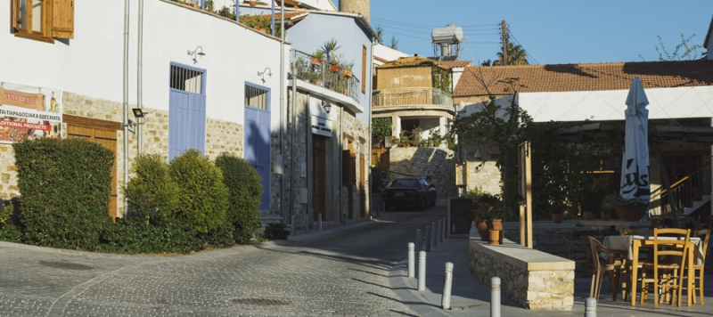
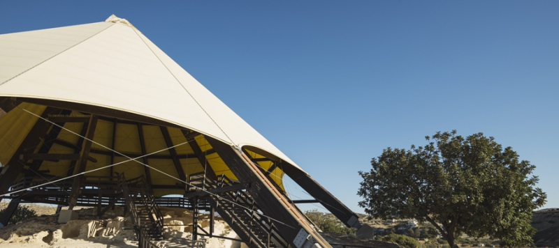
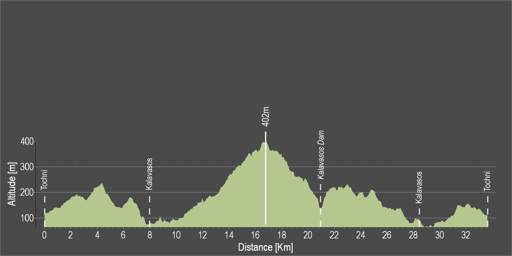
The route starts from beautiful Tochni and heads towards Kalavasos. At a short distance from Kalavasos lies the Tenta Neolithic Settlement dating back to 7000 BC. It is one of the most important Neolithic Settlements on the island and is sheltered by a distinctive cone-shaped roof, which is a contemporary architectural intervention in the landscape. Subsequently, the route ascends and descends again towards the Kalavasos Reservoir and then passes through Kalavasos again before ending in Tochni.
To download the route in gpx format click here
| Distance: | 33.8km |
| Elevation Gain: | 779m |
| Highest point: | 402m |
| Lowest point: | 66m |
| Loop: | YES |
| Terrain: | Mixed |
| Section Distance (km) | Total Distance (km) | |
| Tochni | 0.0 | 0.0 |
| Kalavasos | 7.9 | 7.9 |
| Kalavasos Dam | 12.9 | 20.8 |
| Kalavasos | 7.4 | 28.2 |
| Tochni | 5.6 | 33.8 |

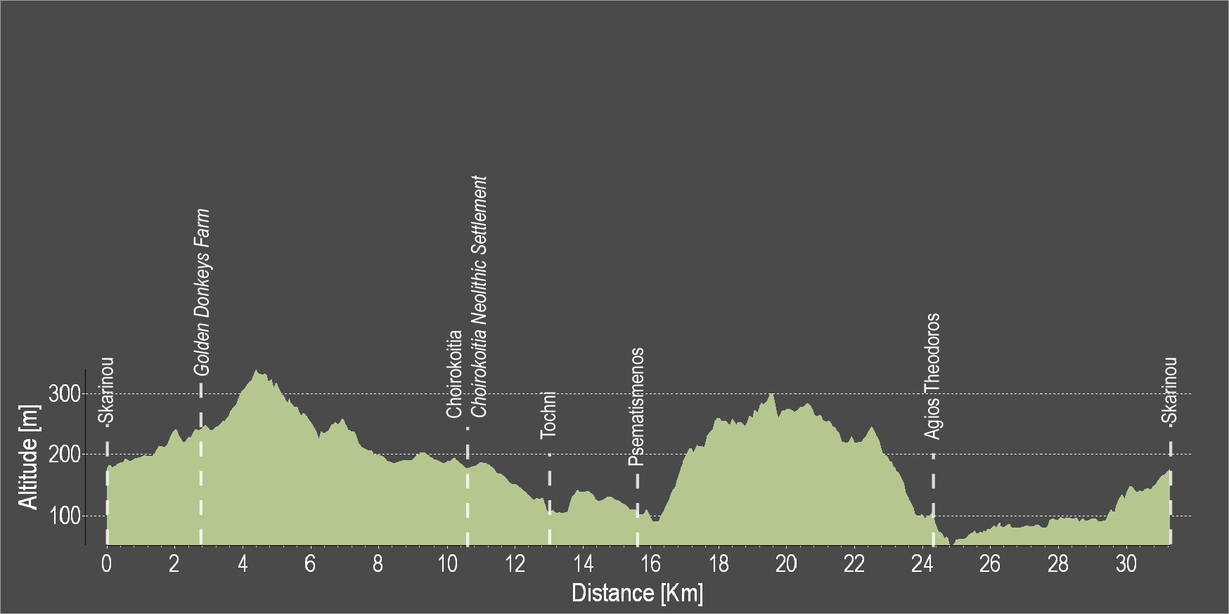
The route starts from the village of Skarinou and heads towards Choirokoitia, by passing by a donkey farm. At Choirokoitia, the Neolithic Settlement of Choirokoitia is located, which has been listed as a UNESCO World Heritage Site since 1998. The route then continues towards beautiful Tochni. Next follows the village of Psematismenos and then the route ascends and descends again towards Agios Theodoros and ends at the starting point in Skarinou.
To download the route in gpx format click here
| Distance: | 31.2km |
| Elevation Gain: | 660m |
| Highest point: | 330m |
| Lowest point: | 59m |
| Loop: | YES |
| Terrain: | Mixed |
| Section Distance (km) | Total Distance (km) | |
| Skarinou | 0.0 | 0.0 |
| Golden Donkeys Farm | 2.4 | 2.4 |
| Choirokoitia | 7.7 | 10.1 |
| Choirokoitia Neolithic Settlement | 2.7 | 12.8 |
| Tochni | 0.0 | 12.8 |
| Psematismenos | 3.1 | 15.9 |
| Agios Theodoros | 9.5 | 25.4 |
| Skarinou | 5.8 | 31.2 |